
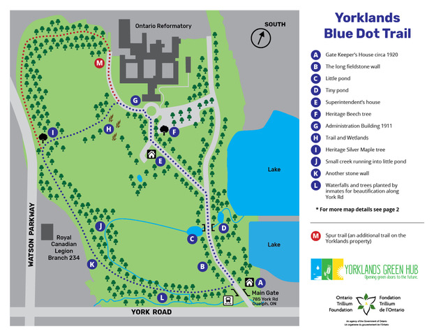
The Yorklands is an amazing space for outdoor learning and adventure. Follow the Blue Dot Trail to see the many cultural and natural heritage spaces.

Guelph Innovation District Maps
The City of Guelph has designated the Yorklands as part of the Guelph Innovation District. You can learn more here. The City of Guelph defines the Guelph Innovation district as:
“A compact, mixed use community that straddles the Eramosa River in the City’s east end. The GID will serve predominately as the home of innovative, sustainable employment uses with an adjacent urban village connecting residential and compatible employment uses. The urban village is meant to be an identifiable, pedestrian oriented space, with street-related built form that supports a mix of medium and high density commercial, residential and employment uses.
It showcases an entirely new approach to planning, designing, and developing urban places, and at the same time, reflects Guelph’s history and celebrates the rich heritage resources of the district, including the stunning river valley, dramatic topography and views, and historic Reformatory Complex.
It protects valuable natural and cultural heritage resources while fully integrating them with the new community, features sustainable buildings and infrastructure, and works towards carbon neutrality. It makes needed connections between all modes of transportation, but in a manner that prioritizes pedestrians, cyclists and transit users over drivers, and stitches the GID into the overall fabric of the City. It is exciting and new and feels like it has been part of the City for a long time. “


